
Thap Lan land disputes linger

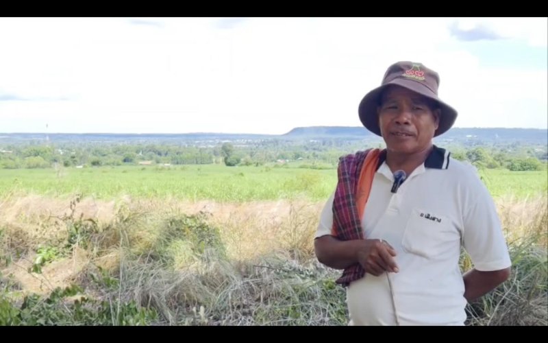
Siho Uthakayotha, 63, was expected to be celebrating. After decades of uncertainty over land occupied by his community near Thap Lan National Park in Nakhon Ratchasima, a decision to remove 155,865 rai of overlapping land from the park boundary was viewed as a long-awaited breakthrough.
Yet Mr Siho, chairman of the Thap Lan 43 group, described himself as only “50% satisfied”.
While the move could bring greater certainty for thousands of farming families, he said several communities remain in unresolved disputes, leaving them to deal with what he described as a long-standing problem passed through successive administrations.
“I am pleased that progress has finally been made, but I cannot be fully happy while other villagers are still facing uncertainty,” he said.
The committee’s decision on June 15 marks one of the most significant attempts in more than 45 years to address overlapping claims between the Department of National Parks, Wildlife and Plant Conservation, the Agricultural Land Reform Office (Alro) and local communities. For many residents, the issue has never centred on political debate or technical mapping, but on homes, farmland and livelihoods passed across generations.
Decades of uncertainty
The dispute traces back to overlapping government designations made over several decades.
Communities were already established in parts of the area before Thap Lan was declared a national park in 1981.
Some land had previously been allocated for agricultural reform, while other settlements were created under security-era policies supporting villagers during the communist insurgency period.
When park boundaries were later formalised, thousands of residents found themselves living inside a protected zone.
Many residents have lacked legal certainty over housing and farmland.
Some have faced criminal complaints and legal proceedings, while others have struggled to transfer land to descendants or access financial support.
According to Natural Resources and Environment Minister Suchart Chomklin, the latest decision aims to address long-standing legal and administrative uncertainty affecting communities for nearly half a century.
“If we do not solve it now, people who have lived there for decades will continue facing legal action,” he said.
He stressed that the decision does not represent a blanket reduction of protected forest land. Instead, the disputed area has been divided into five groups based on historical documentation, cabinet resolutions and land-use records.
The first group covers about 55,000 rai previously designated for agricultural reform in 1978, prior to the national park’s establishment.
The second group comprises more than 8,000 rai in Ban Thai Samakkhi, which was allocated under a 1977 cabinet resolution linked to anti-communist operations.
The third covers more than 80,000 rai associated with former security settlements approved under a 1992 cabinet resolution.
The fourth group consists of land designated for public or administrative purposes and remains under review due to overlapping claims.
The fifth comprises approximately 6,000 rai of military training areas.
Mr Suchart said that these categories reflect legal foundations that pre-date, or operate independently from, the national park designation, forming the basis for their removal from the protected boundary.

Suchart: Looking to resolve problems
Forests and land balance
Conservation groups raised concern after the announcement that more than 155,000 rai would be removed from Thap Lan National Park.
Environmentalists warned of potential impacts on protected ecosystems and broader conservation objectives.
In response, the government said the overall balance of conservation land is being maintained through a broader land reallocation process.
Mr Suchart said that while 155,865 rai would be removed from the park boundary, close to 90,000 rai of forest land elsewhere would be brought under protection through a land-swap arrangement. He said the intention is to maintain conservation outcomes while addressing long-standing disputes affecting an estimated 20,000 to 30,000 low-income families.
“People see headlines saying more than 100,000 rai of forest has been removed,” he said. “In reality, nearly 90,000 rai is being added back into protected status.”
The government maintains that no intact primary forest is being allocated for development.
Attapol Charoenchansa, director-general of the Department of National Parks, Wildlife and Plant Conservation (DNP), said most of the land identified for removal consisted of areas previously designated by the state for settlement or agriculture before the national park was established.
He added that conservation expansion would continue where appropriate, while some areas may be managed as community forests under joint arrangements between residents and state agencies.
Legal cases remain
Attention has increasingly focused on what is classified as Group 4, which remains inside the national park boundary.
Covering more than 100,000 rai and involving around 5,200 claimants, it is the most legally complex category of disputed land, said the DNP chief.
About 450 active cases are currently before the courts, accounting for the majority of the roughly 550 land-related cases recorded across all five groups.
Many involve allegations that private investors and resort operators have occupied land intended for agricultural use, said Mr Attapol.
The DNP has therefore suspended administrative decisions on this group for six months while each claim is verified individually.
He said the department would rely on aerial imagery, historical records and data from the government’s One Map system in assessing each case. The aim is to distinguish between long-standing residents and unlawful occupation of state land.
“We are not legitimising land use so that resort operators can retain possession,” Mr Suchart said separately. “Where encroachment is proven, legal action will follow.”
He added that commercial developments found to be located on state land would be subject to enforcement procedures.
The One Map approach
An academic in Nakhon Ratchasima has highlighted the One Map system as a key tool in addressing long-standing boundary disputes in the Thap Lan area.
Thawisan Lonanurak referred to the cabinet resolution of June 14, 2023, which introduced a 1:4,000 integrated land mapping framework known as One Map. The system combines datasets from the Royal Forest Department, the DNP and Alro into a single reference for disputed areas covering about 265,285 rai.
He said the approach replaces fragmented mapping systems that have long contributed to overlapping claims, enabling clearer identification of land status, including agricultural zones, conservation areas and state land boundaries.
“One Map helps clarify overlapping land boundaries across agencies,” he said.
He added that the unified system could reduce long-standing uncertainty by standardising spatial data used by different state bodies, while supporting more consistent land-use decisions and future planning. He noted that the framework may also help reduce disputes between affected communities, the DNP and Alro as long-standing classifications are reassessed under a single mapping standard.
Nearly half a century after the conflict began, the challenge extends beyond redrawing lines on a map.
It remains a question of balancing conservation, legal certainty and long-standing community livelihoods.

Thawisan: Touting One Map system
Source – Bangkok News